The Wells Family Home: 1903-1981
Thanksgiving 1972

Spring 2025
On the Market in 2013
 The appearance of 179 Belleville Avenue on the market in the 2013 sparked my interest in the home's history. (It sold for $175,000 on May 6, 2013.) This sent me off on a document trail that eventually led to a deed search at the Office of the Essex County Register of Deeds and Mortgages' Hall of Records, Newark, New Jersey.
But that's not where the trail began...
Census Data
I went to the 1900 Census (see below) to find out who probably lived at #179 when my great-grandparents, Dr. F.C. and Clara Wells moved to Bloomfield in 1903 from Chicago—a house they rented at 883 Monroe Street, to be precise (according to the 1900 Census). I found that Andrew and Mary Allen shared #179 with two children under the age of two, Andrew's mother and father, and a cousin, and a staff consisting of a "nurse" (nanny?), "servant" and Irish-from-Ireland "coachman"! Ten humans! The 1900 Census has his profession as "voice culture." I guess elocution lessons must have paid pretty well back then. The Census data also tell us that the Allens owned 179, and that it was mortgaged.
Select an image to enlarge it.
 Data continue from above—including column headings.
But when was the house built and when did the Allens move in? The 1900 Census clearly indicates that the Allens were there by then, but, alas, the previous Census data, from 1890, was destroyed by a fire in 1921! And I can't find the house in the earlier, 1880 Census. Thus, by Census data alone we can only say that it was built between 1880 and 1900.
Before moving on from Census data, consider one interesting bit of information from the 1905 New Jersey State Census (below). F.C. and Clara had moved to #179 two years earlier, in 1903. The 1905 Census recorded that they lived there with a German "maid," an Austrian "servant," and an American "coachman" (from Virginia). It also recorded that they rented, not owned, the house! We'll come back to this later in the story of my research.
Let's move on to other documents regarding 179 Belleville Ave!
Bloomfield City Directories
The Montclair Public Library has made many city directories for Montclair and neighboring Bloomfield available. It's quite the treasure trove of information.
The section of Belleville Avenue that includes #179—between Williamson Avenue and Orchard Street—did not have house numbers through much of the 19th century. Numbered houses can be found for the first time in the 1891 directory. For example, Henry P. Dodd, of the Thomas Oakes & Co. woolen mill, lived at 182 Belleville Av, which was on the same block as #179, but across the street, between Williamson Avenue and Fairview Avenue (soon to become Clarendon Place, which dead ends at Belleville Ave.). However, there is no 179 Belleville Ave. listed in 1891, nor would there be in directories through at least 1896.
The 1898 Bloomfield Directory: First Official Record of #179 Belleville Avenue!
 Directory page Millers at 179.jpg)
The first directory with a numbered house at 179 Belleville Av. is from 1898. This, then, is the first hard evidence I've found for a structure with that house number.
Surprisingly, the Allens were not living there then, even though they bought the house three years earlier and would be listed there in the 1900 Census—just two years later. Instead of the Allens, the 1898 Directory lists the Miller family at #179: Carrie (widow of Hugh), Frank, and Harry (a student). The relationships of these three folks are not specified in the directory.
Thus, the Millers are the earliest inhabitants of a Belleville Avenue house numbered 179 that I have found in any official source! But there's more to this story, as the Millers are not listed in any of the deed records (see below) and were renting #179 from the Allens at the time of the 1898 Directory.
Bloomfield Maps
There are a number of interesting Bloomfield maps—especially in light of what the Bloomfield directories tell us. And the Historical Society of Bloomfield and the Montclair History Center have assembled lists of pertinent maps.
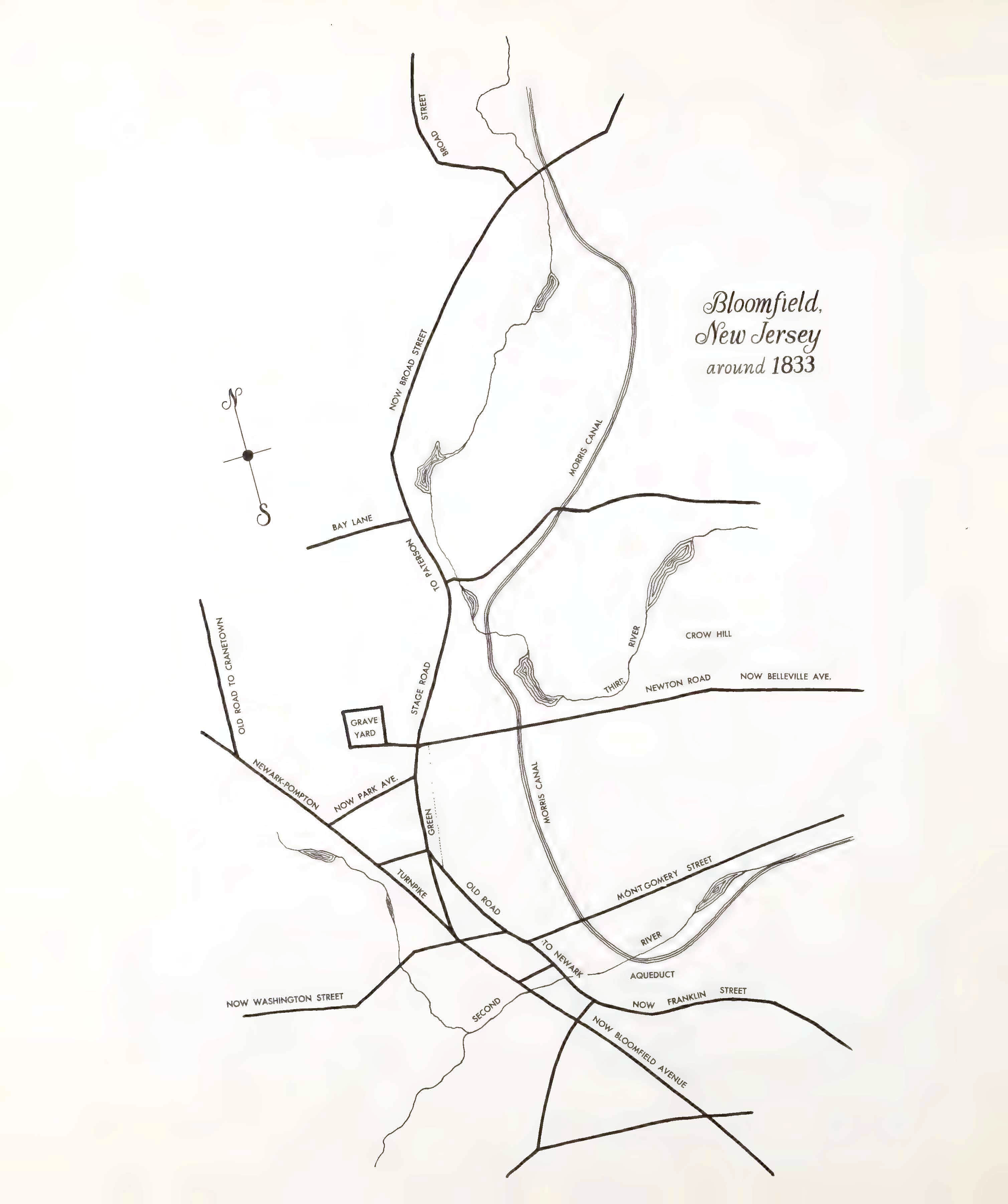
1830 Oakes Map (Compiled Circa 1900)
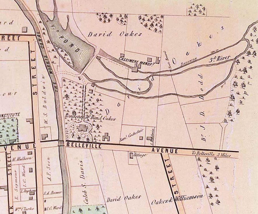
A map of Bloomfield as it appeared circa 1830 was evidently compiled by John Oakes circa 1900, and later (1912) drawn to scale by John F. Capen. It appears in The Mill on the Third River: A History of the Davey Company Makers of Binders Board Since 1842, by Helen Baker Cushman (New Jersey Historical Society, 1992), p. 30. (The book chronicles the history of Davey's Fustian Mill, not Oakes's Cassimere Mill.)
Oakes's map is contemporaneous with the digging of the Morris Canal, which provides a clear landmark for identifying the property that would become 179 Belleville. In the detail from the map (below), the 179 property would have been south of the "three" in the "3rd RIVER" label. Another landmark is the mill pond, where David Oakes started a textile factory in 1830 (see Bloomfield: Old and New, p. 144). Also, the Bloomfield Graveyard, where several Wells family members were buried in the 20th century, can help orient us.
The map's key informs us about the following locations on Belleville Ave:
- 18: Granny Baldwin's
- 19: Capt. Tuckers
- 20: Joel Dunham
- 21: Davey's Fustian Mill ("Fustian is a variety of heavy cloth woven from cotton, chiefly prepared for menswear," according to Wikipedia.)
Select an image to enlarge it.

1833 Map
150 Years Around the Green: A Brief History of Bloomfield, NJ, 1812-1862, by Rachel F. Diamond, includes a very schematic map, without much detail. However, the map detail above clearly indicates the Mill Pond and Third River, allowing us to imagine where 179 Belleville would be.
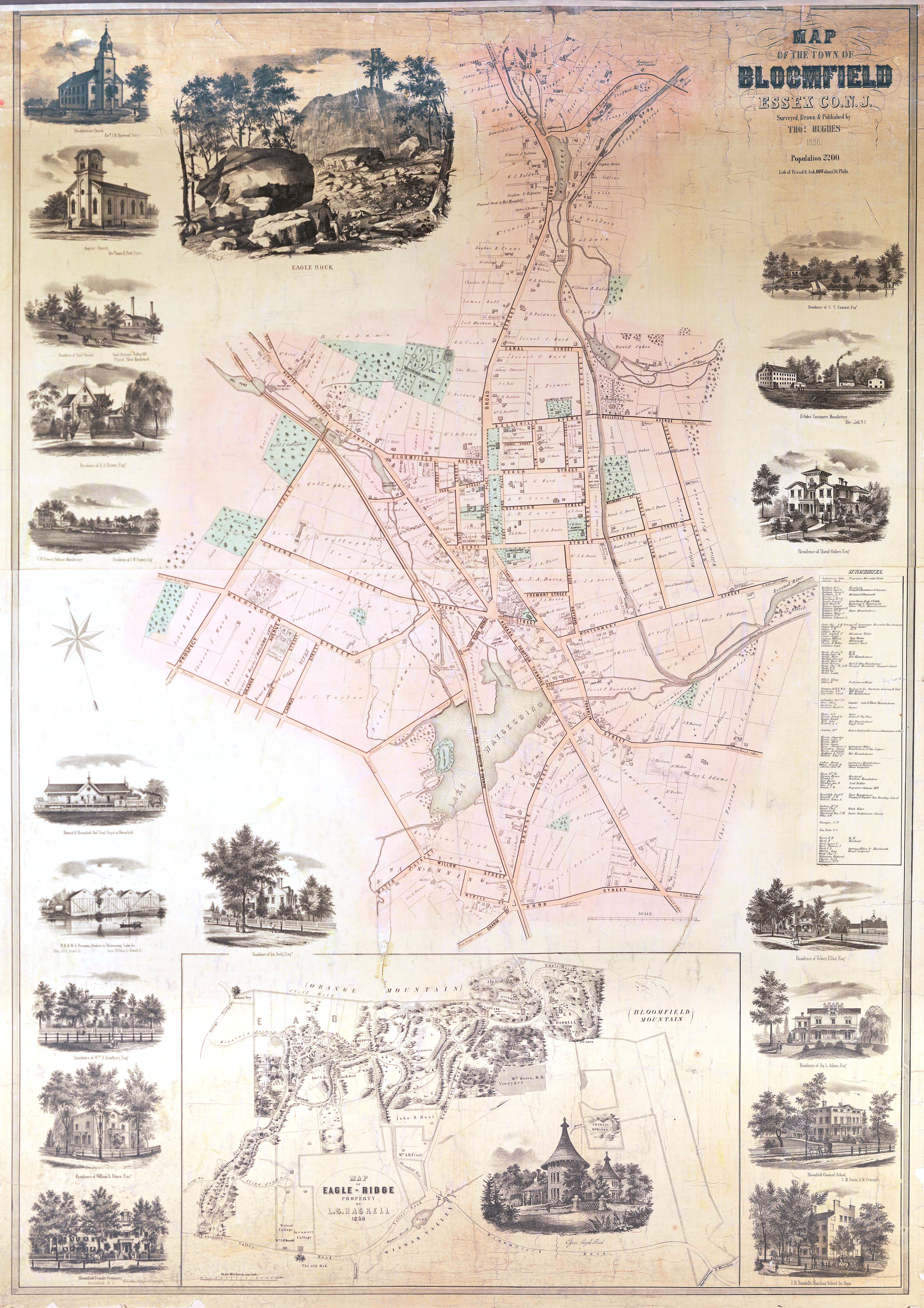
1856 Hughes Map
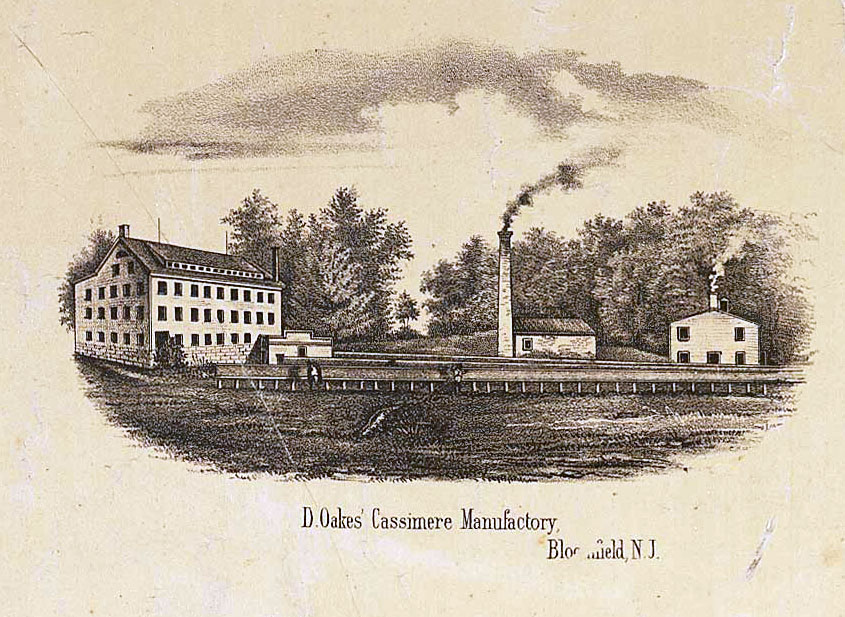
Thomas Hughes's map is the earliest one I've found that includes drawings of structures on the properties. David Oakes's "Cassimere Manuf[ctory]" on the Third River has replaced Davey's Fustian Mill and an inset detail shows us what the Manufactory looked like (see drawing below)!
The scale of David Oakes's house and land is clearly represented, too—bordered by Sam Cockefair and S. Baldwin. It appears there was a road going from his house to his manufactory. Best I can tell, 179 Belleville would be a little to the east of Baldwin's house.
1867 Map
In 1867, Belleville Avenue looks much the same as it did in the 1856 map, as far as the Oakes and Williamson properties go, but Dr. J. D. Dodd seems to have sold much of his property to W. D. Stafford and Randolph and Barrett. (Source: The Mill on the Third River, p. 66.)
 cropped.jpg)
 cropped to whole map.jpg)
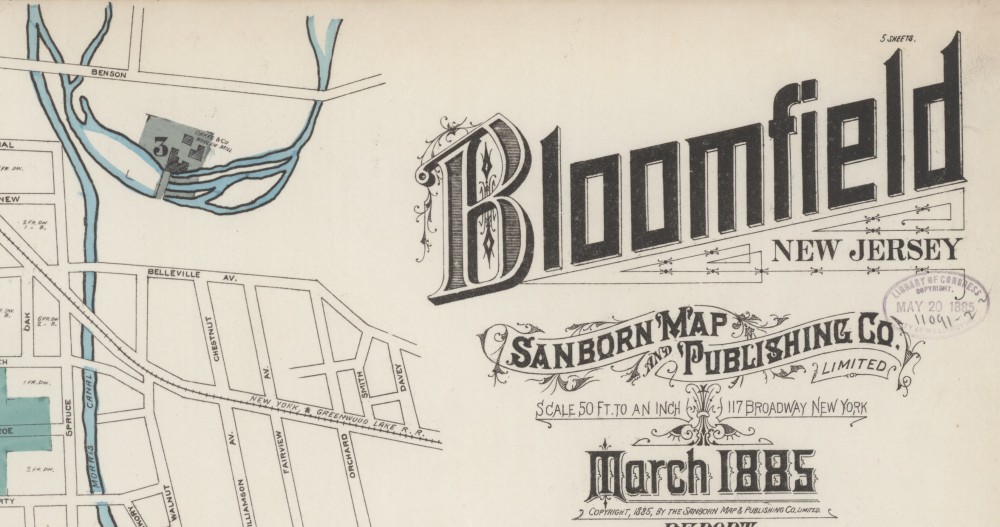
1885 Sanborn Map
The greatest map resource for the late 19th- and early 20-centuries are the Sanborn Fire Insurance Maps. As Wikipedia explains, "the maps were created to allow fire insurance companies to assess their total liability in urbanized areas of the United States. Since they contain detailed information about properties and individual buildings in approximately 12,000 U.S. cities and towns, Sanborn maps are valuable for documenting changes in the built environment of American cities over many decades." Fortunately, several of these historic maps may be found on the Library of Congress' Website.
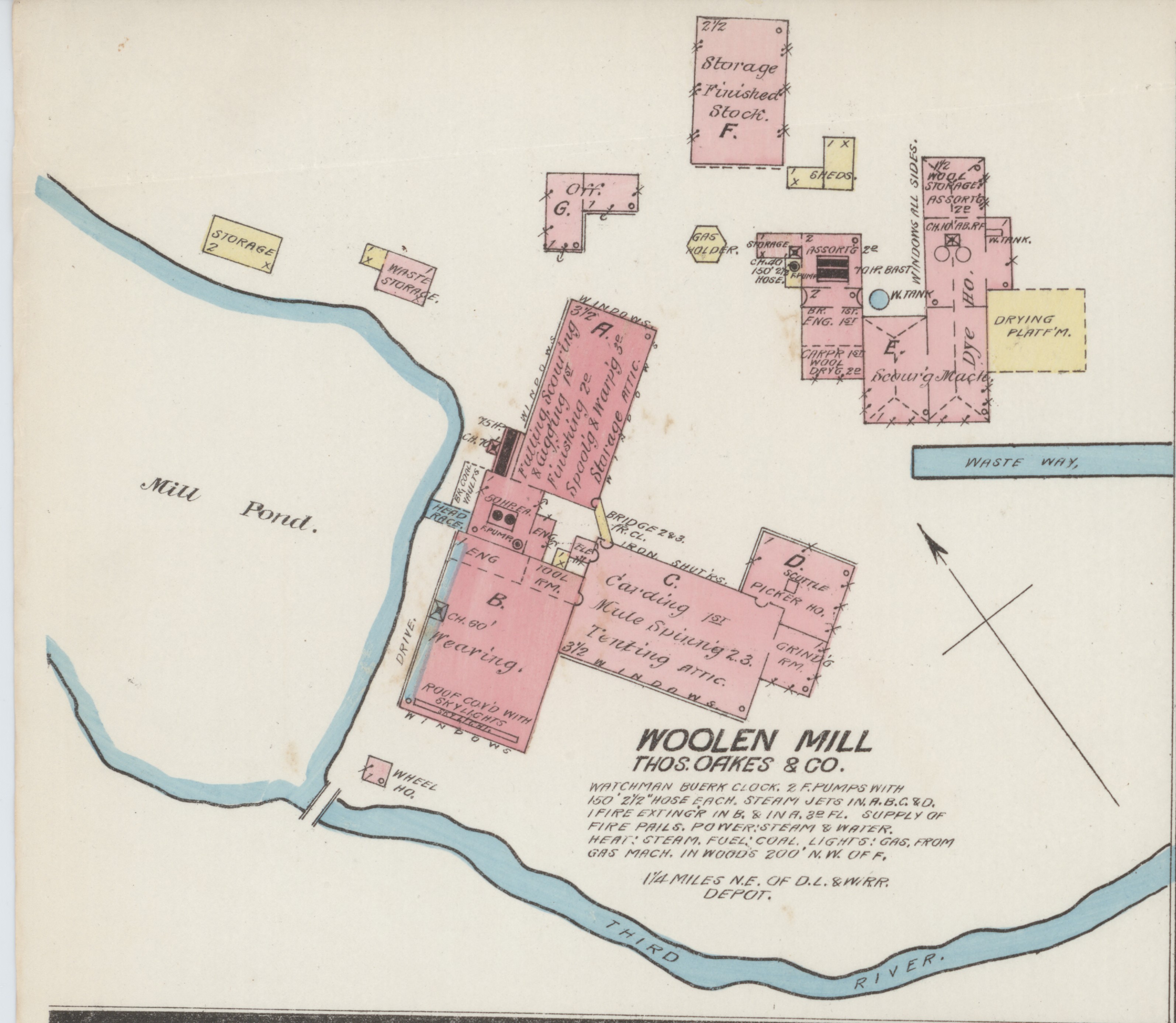
The Sanborn company came to Essex County and created a detailed map for fire-insurance purposes. The key to the map includes the area on which #179 would be located, but, sadly, does not draw structures that existed there (below). Section 3 of the map goes into precise detail about the Oakes Mill, spelling out the factory's firefighting capabilities (below).
Select an image to enlarge it.
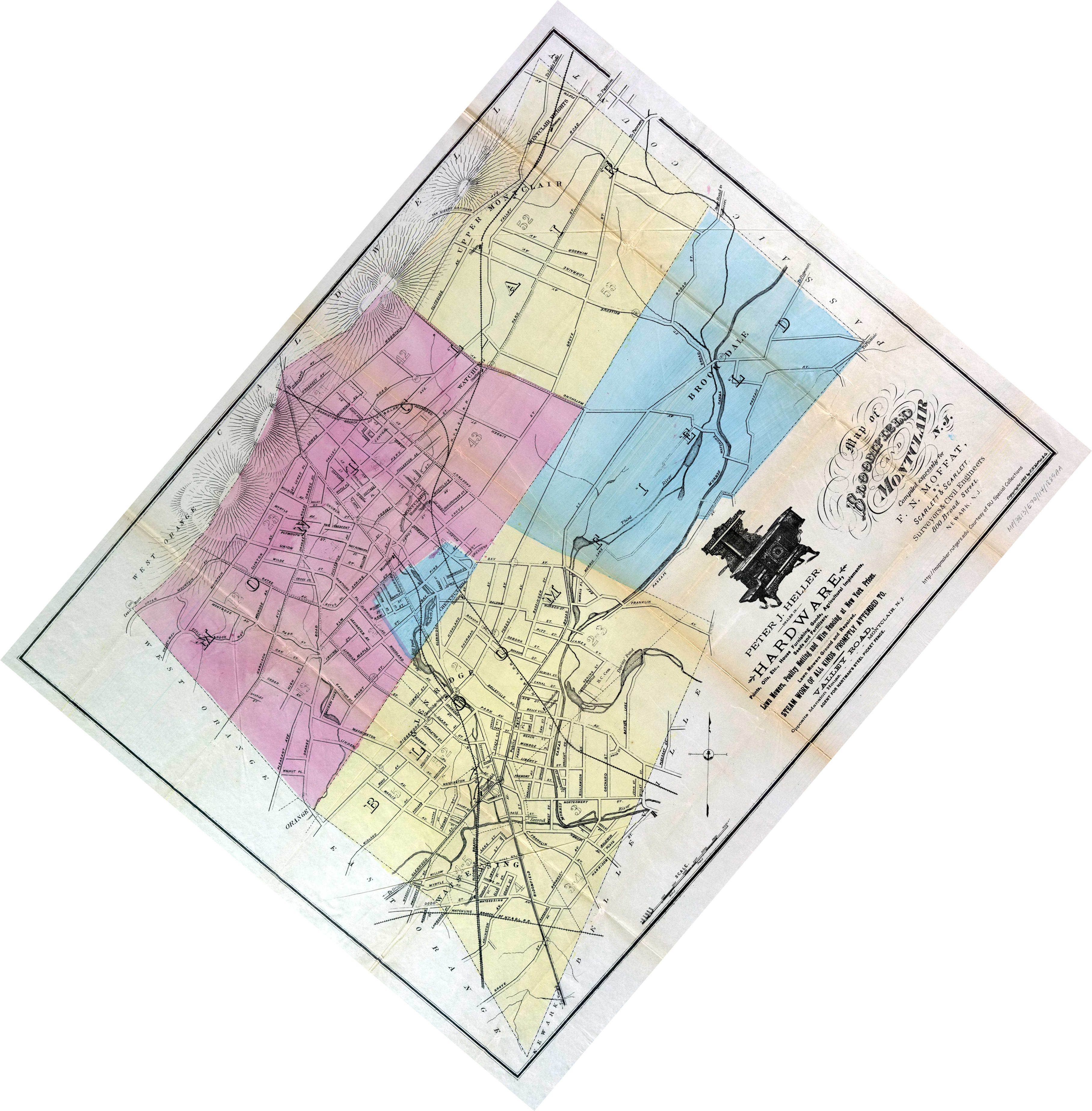
1889 Moffat Map
An 1889 map "compiled expressly for F. N. Moffat by Scarlett & Scarlett, Surveyors & Civil Engineers, 800 Broad Street, Newark, NJ" does not show much by way of structures, but it confirms how Belleville Avenue crossed the Morris Canal. The #179 property would be about where the "V" in "AV" is placed. Fairview Avenue (today's Clarendon Place), running parallel to Williamson Ave. and Orchard Ave., does not officially exist yet. (Source: Rutgers University Libraries.)
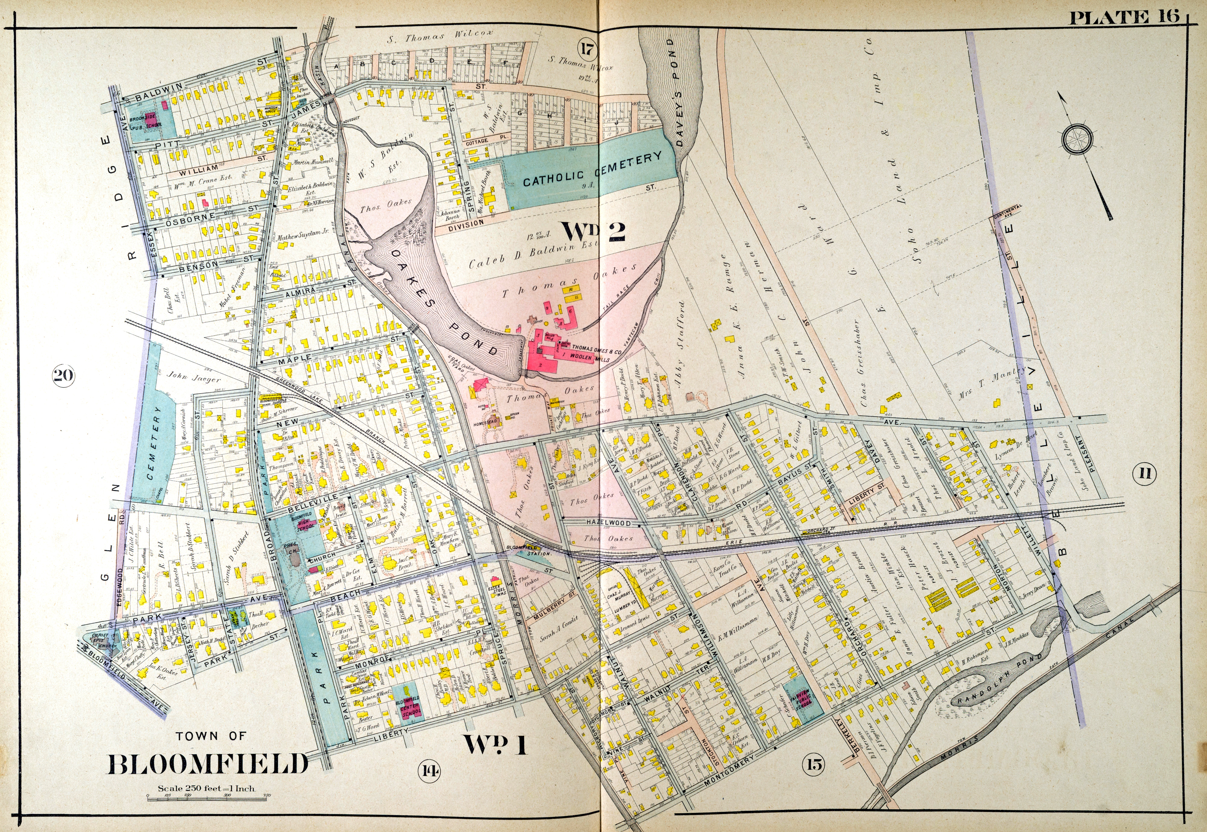
1890 Robinson Atlas of Essex County
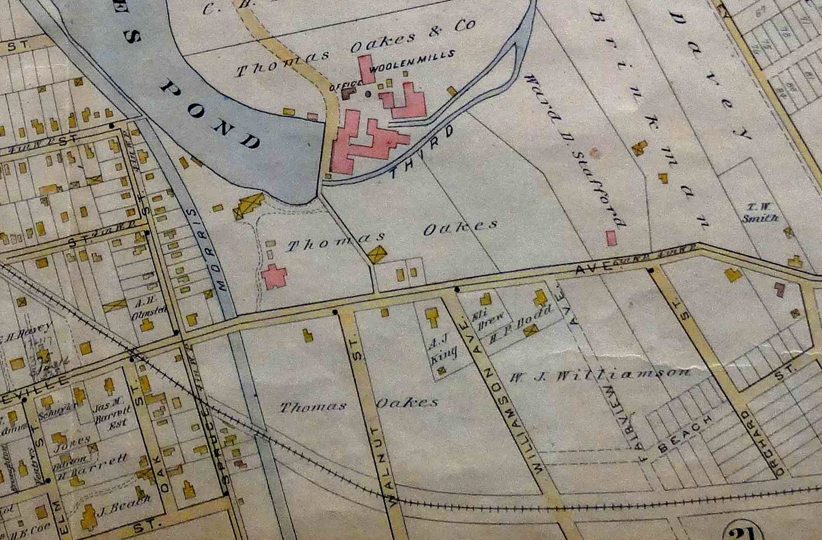
The 1890 Atlas definitely shows that there were no structures on the north side of Belleville Ave, where it intersects with Fairview Ave. (later Clarendon Place). The land where #179 would stand was controlled by Thomas Oakes and the Oakes Woolen Mill was just north of that property. Henry P. Dodd, according to the 1890 City Directory, lived at "Belleville av n[ear] Williamson av." His property can be seen between Williamson and Fairview on the map. The full Atlas is online. Source: Historical Society of Bloomfield.
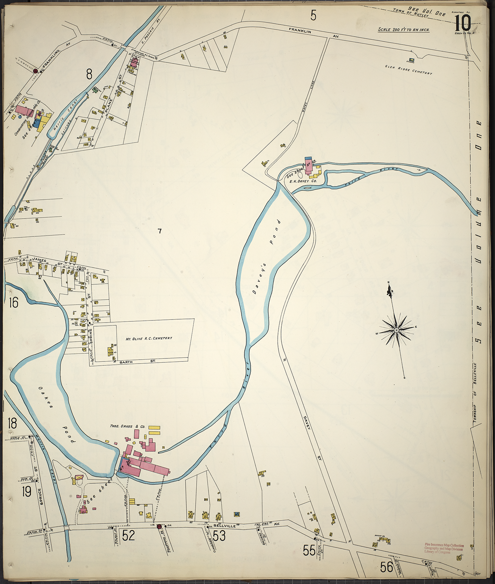
1906 Mueller and Sanborn Maps
I've struggled to find a Bloomfield map between the time of the Robinson Atlas (1890) and the first appearance of #179 in the Bloomfield directory (1898). My best guess is that 179 Belleville was built in that window, in the months leading up to April 1895. The closest I have come to an 1895 map are Mueller and Sandborn maps from 1906.
The Mueller map, in particular, clearly shows a house at #179, with a porch and its distinctive driveway that curves to the left. Even though the Wells family had moved in by 1906, the map shows the property as being owned by "Mary T. Allen." This is because the Wellses rented it until 1907. It is a bit curious that the property was in Mary's name and not that of her husband, Andrew.
The Sandborn map, below, has less information about homeowners, but it has numbers (dimensions?) for fire-insurance purposes.
I find it interesting, having only known 179 Belleville since the Garden State Parkway cut through Bloomfield, that the 179 property extended virtually to the Oakes Woolen Mills and Yantecaw Creek (aka, the Third River). Did the Wells children play in that creek on a hot summer's day? Also, note that the Bloomfield train station was a short, two-block walk from #179.
Click on either map below to see a full-sized image.
1906 Mueller Map
1906 Sanborn Map that shows the 179 house in detail, including its wrap-around front porch!
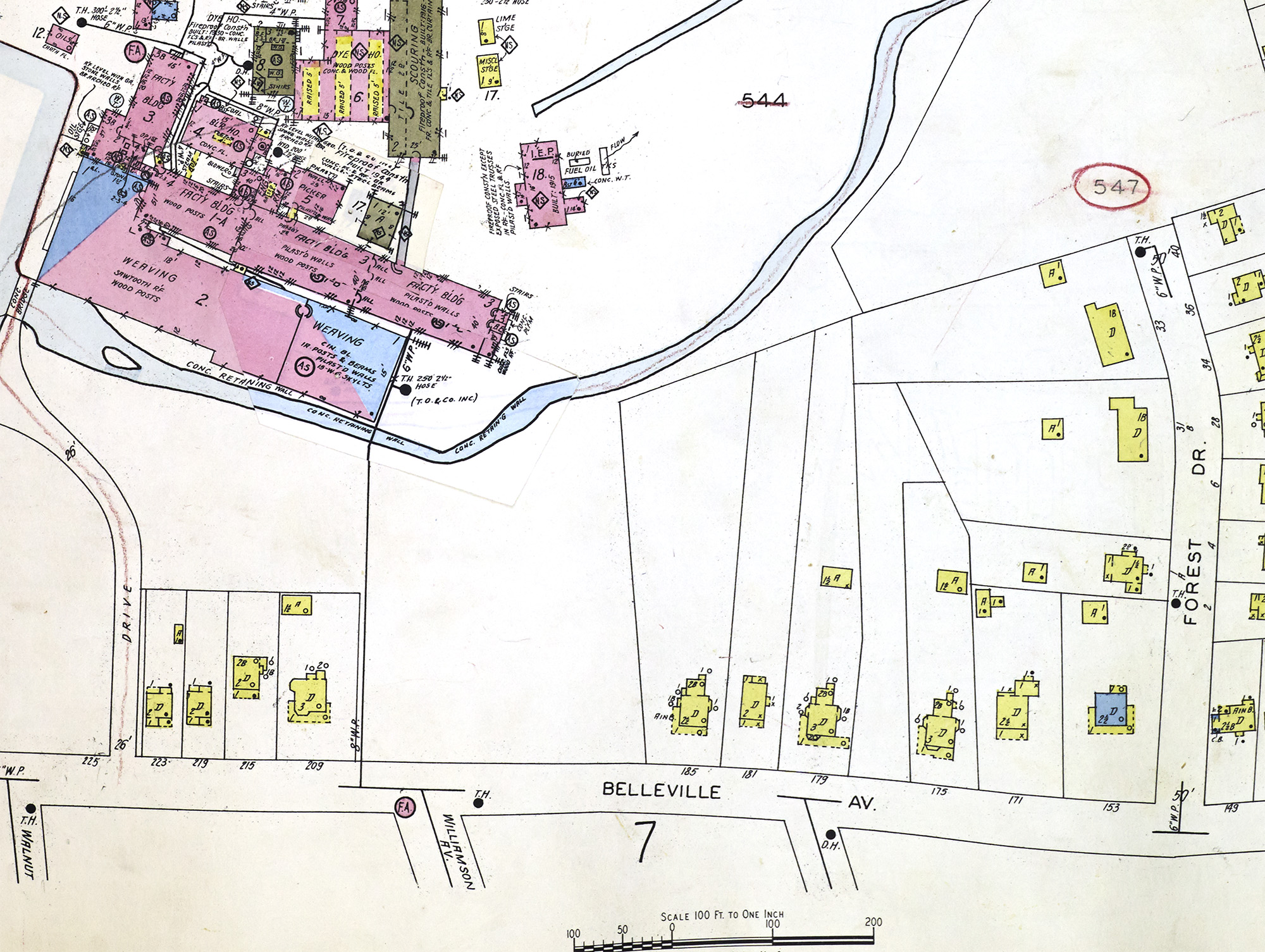
1938 Sanborn map
Much as in the 1906 Sanborn map, the 1938 update captures details of the structure at #179 and the garage behind it. It also contains precise details for the Oakes Woolen Mill that would soon become a casualty of the Garden State Parkway.
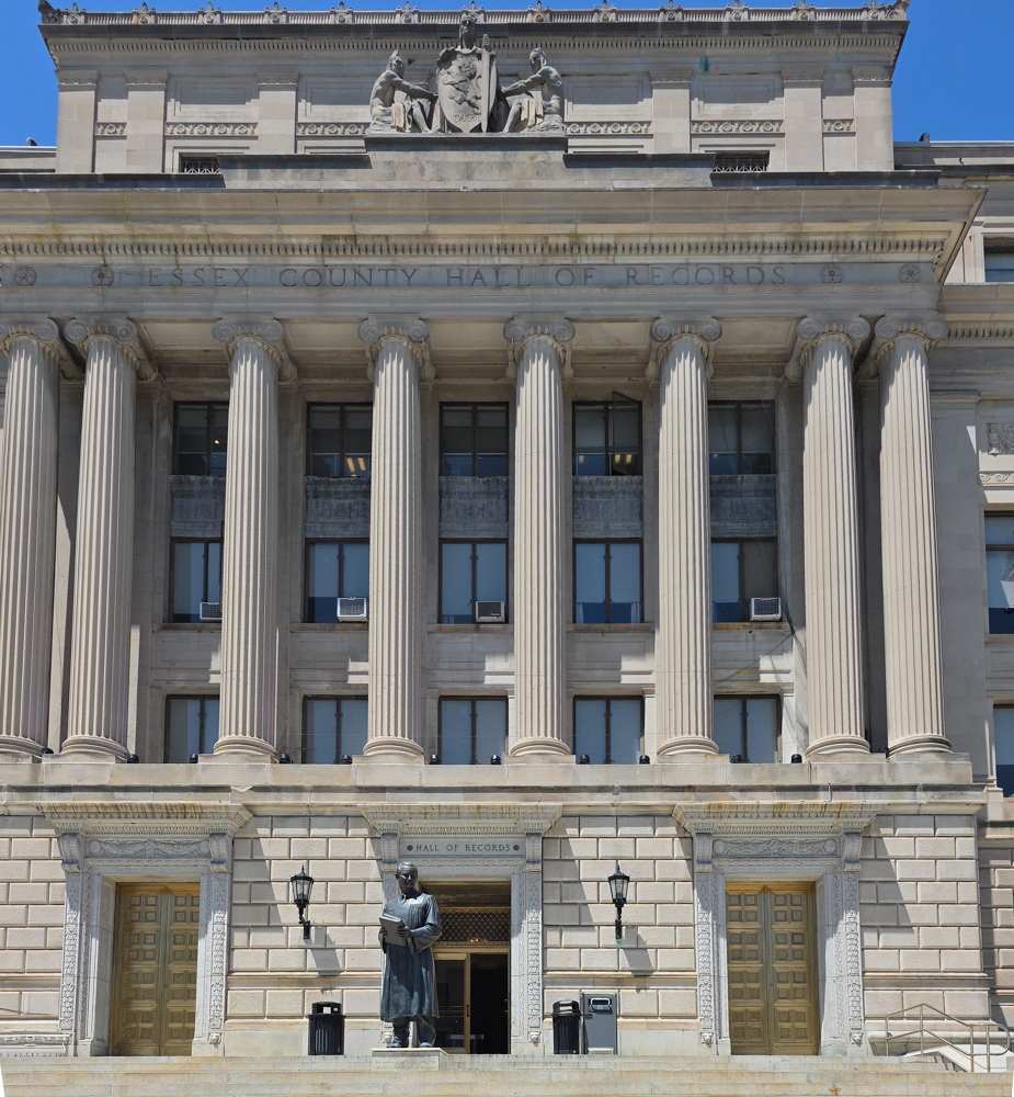
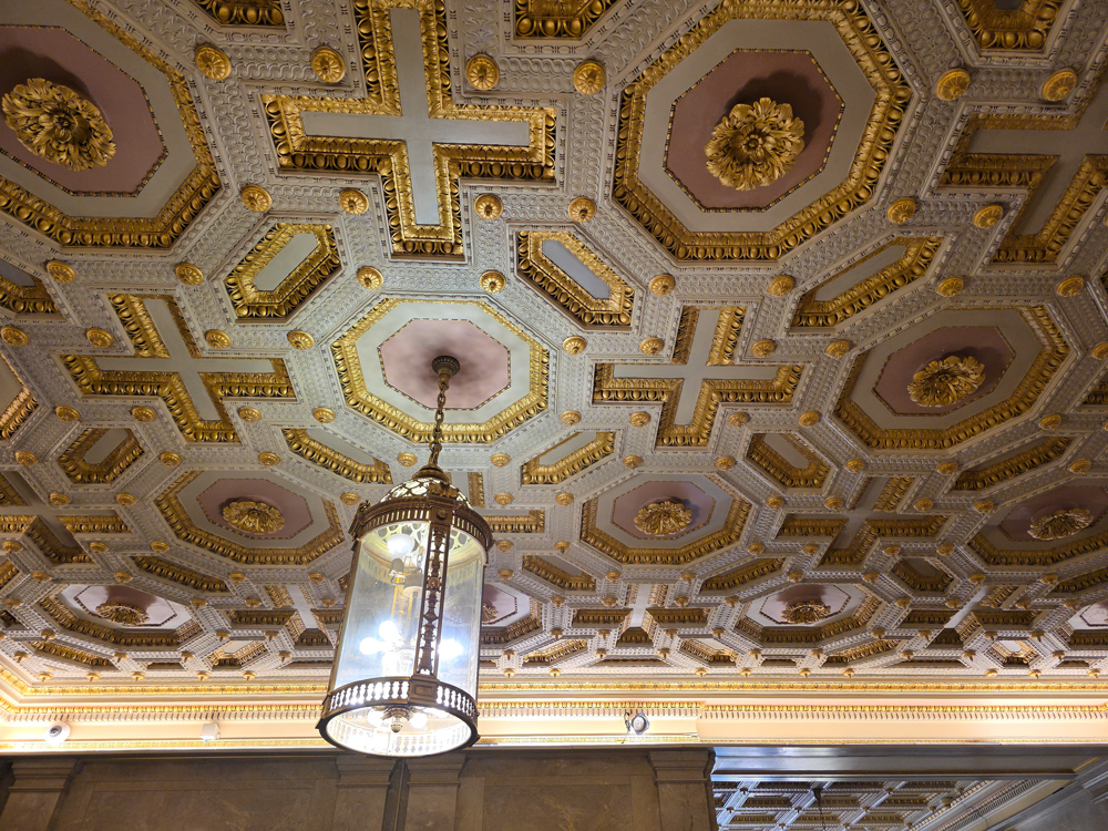
A Visit to the Essex County Register of Deeds
On May 19, 2025, I paid a very pleasant and productive visit to the Office of the Essex County Register of Deeds and Mortgages' Hall of Records—Room 130, 465 Martin Luther King, Jr. Blvd. Newark, New Jersey. A helpful clerk named Patrick set me on the deeds trail for 179 Belleville Avenue, aka lot 27, block 547.
Select an image to enlarge.

The Deed Book Room
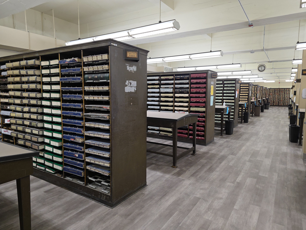
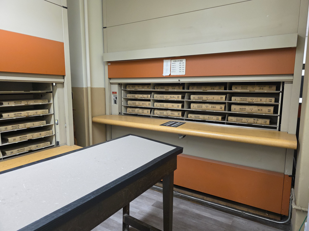
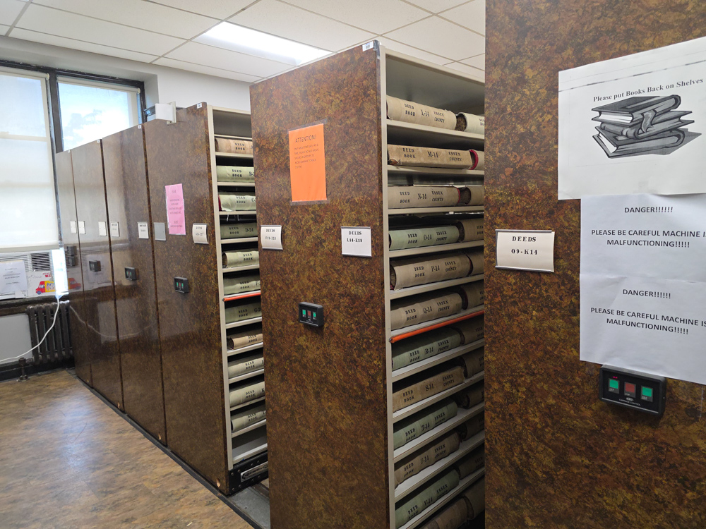
The middle image above shows the mechanized device that holds indexes to the deed books. Patrick used this to begin the search. The index told us which deed book contained the last sale's information—filed April 11, 2013, when Marc Coogan ("guarantee") bought it from Vahan and Linda Khoyan ("guarantor").
Data from Maps, City Directories and Deeds
The table below sums up what I've learned from maps, city directories, and deeds. Deed "conveyances" are highlighted in yellow. What do all these data tell us about the Wells family and 179 Belleville Avenue?
Executive Summary, Part 1: The Wells Family at #179
- 1903: Dr. F. C. and Clara Wells—along with their children F. C., Jr., Elizabeth and Howard—began renting the house from Mary and Andrew Allen in 1903.
- 1907: The Wellses purchased it (via mortgage).
- 1923: FC Wells, Sr. died on December 19.
- 1931: FC, Jr. and Sophie's family (daughters: Sophia, Lydia, Gay, and Penelope) moved in with his mother, Clara, at #179. They had been living with Sophie's father, Gaylord Starin White, in his apartment at Union Theological Seminary. Upon his death on November 25, 1931, they were forced to move (see NY Times obituary and the White-Wells overview).
- 1956: When Clara died, it was "sold" to FC, Jr.; his four daughters had all moved out by then.
- 1969: FC, Jr., died on December 1.
- 1981: Soon after Sophie died in 1980, the property was sold by the family—probably in the spring of 1981.
Executive Summary, Part 1: The Property and House at 179
- 1881: The property that would become 179 Belleville entered the public record in 1881 when Chauncey L. Cooke died and left it to his daughter, Sara L. Cooke. The Cookes were a wealthy family who lived in New York City (Brooklyn).
- 1888: Sara and her aunt Mary sold it to Henry P. Dodd, who lived near there (at 182 Belleville Ave., across the street). I have surmised that Dodd built the house at #179, although there is no official record confirming this. Supporting this assumption is the fact that Dodd bought the property for $2,600 in 1888 and then sold it for three times as much ($8,300) just seven years later. Surely the property, without a house on it, could not have tripled in value in such a short time. The City Directory ending May 1, 1894 shows no listing for #179.
- My best guess, therefore, for when the house was built is 1894-1895, by Henry P. Dodd, in the months before selling it in April 1895.
- 1895-1898: Henry and his wife Caroline Dodd sold the property to Mary and Andrew Allen on April 15, 1895. The Allens did not immediately live there, but, rather, rented it to Carrie Miller (as per the 1898 City Directory). Neither Millers, nor Allens, nor anyone else is listed at #179 in the Directory covering May 1, 1895 to May 1, 1896, but I think it's fair to assume that the Directory listing lagged behind actual occupancy and thus that someone moving into a house in April 1895 might not be included in a directory published the following month.
- 1900: The Allens themselves occupied the house by the time of the 1900 Census.
- 1907: Clara and F. C. Wells, Sr., purchased it for $8,000—$300 less than the Allens paid for it.
- 1956: The executors of Clara Wells's will sold it to Sophie and F.C. Wells, Jr.
- 1981: Sophie Wells sold it to Anthony E. Callori and Sallyanne Floria.
- 1983: Callori and Floria sold it to Louis Pagonis.
- 1986: Pagonis sold it to Louis and Victoria Pagonis (refinancing? ownership change due to marriage?).
- 1994: The Pagonises sold it to Vahan and Linda Khoyan.
- 2013: The Khoyans sold it to Marc Coogan (and Christina MacIsaac). As of June 2025, they are the current owners/occupants.
| Date Recorded | Guarantor | Guarantee/Occupant | Transaction Amount | Comment/Source |
| 1/1/1880 | No occupant. | Bloomfield house numbers had not yet been established, but 1880 Census shows residents in this area of Belleville Avenue | ||
| 6/7/1881 | Chauncey L. Cooke, deceased | Sara L. Cooke | $10.00 | Deed book ??, p. 531. Bequeathed from father to daughter. 3 and 21/100 acre. "in the presence of Mary Cooke," Chauncey's sister. |
| 5/1/1885 | Henry P. Dodd—Thomas Oakes & Co., "Belleville av n[ear] Williamson av" (not a street number) | 1885 Directory; Dodd's home would become 182 Belleville. | ||
| 5/29/1888 | Mary and Sara L. Cooke | Henry P. Dodd | $2,600.00 | Deed book O 24, p? |
| 1889 | None | 1889 Moffat Map | ||
| 1890 | None | 1890 Robinson Atlas shows no house or property boundaries at 179. | ||
| 1891 | None | First city directory with house numbers on Belleville. E.g., H. P. Dodd is listed at 182 Belleville Avenue. Dodd did insurance and real estate after working for Oakes & Co cloth mfr; office at 205 Walnut; home at #182 (where he lived his entire life). | ||
| 5/1/1894 | None | 1894 Directory: H. P. Dodd, 182 Belleville Av; no Allens or Millers. | ||
| 1895 | None, until sale to the Allens (below). | 1895 NJ Census shows Oakes and Dodd in Bloomfield, but no Allens or Millers are listed near them. | ||
| 4/15/1895 | "Henry P. Dodd and Caroline his wife" | "Mary Flintoff Allen, wife of Andrew Smith Allen" | $8,300.00 | Deed book C-29, pp. 235, 237. Adjoining property of Thomas Oakes. Deed mentions land "and premises"—meaning buildings? |
| 5/1/1898 | Carrie Miller, wid Hugh; Frank, Harry (student) | 1898 Directory; first directory with house at #179. | ||
| 1/1/1900 | Mary Flintoff and Andrew Smith Allen | 1900 Census | ||
| 5/1/1902 | Andrew S. Allen, laundry | 1902 Directory. Henry Dodd at 182 Belleville Av; Catherine, Edmund and Annie Bohr family was at 80 Belleville Av. | ||
| Circa January 1903 | Wells Family | According to a New York Times article, Dr. F. C. Wells was promoted to chief medical inspector of the Equitable Life Assurance Society in January 1903. Presumably, his family joined him soon afterward. | ||
| 1/1/1904 | Franklin Wells, MD, physician | 1904-05 Directory | ||
| 5/1/1904 | Franklin C. Wells, MD; Wm. Murray, gardener | 1904 | ||
| 1/1/1905 | Franklin, Clara, Franklin, Jr., Howard, Elizabeth—renters. | 1905 NJ Census; includes maid, servant, and coachman | ||
| 1/1/1906 | Wellses (renters) | 1906 Sanborn map | ||
| 1/1/1906 | Allens (owners) | 1906 A H Mueller map | ||
| 4/15/1907 | Mary Flintoft Allen | Clara Downs Wells | $8,000.00 | Deed book A-41, p. 393. The Allens were already residing in Pasadena. Mortgage of $4,500 at 5% interest--now a lien upon the premises? |
| 1931 | FC & Sophie Wells family moved in with Clara Wells—vacating Gaylord White's apartment at Union Theological Seminary. | See NY Times obituary, Wikipedia article and the White-Wells overview. | ||
| 1/1/1938 | Clara Downs Wells and the FC & Sophie Wells family | 1938 Sanborn map. | ||
| 5/5/1956 | FC Wells, Jr & Elizabeth Wells Shoemaker | FC and Sophie Wells | $12,500.00 | Deed book 3443, p. 427. Guarantors as executors of will of Clara D. Wells. The Wells daughters had all moved out. |
| circa 1981 | Wells | Probably Anthony E. Callori and Sallyanne Floria. | After death of Sophie Wells in August 1980. Floria was Essex County’s Presiding Family Part Judge. | |
| 10/26/1983 | Anthony E. Callori and Sallyanne Floria | Louis Pagonis (single) | Deed book 4,805, p. 325. This deed book would likely have information on the previous "conveyance" by the Wells family to Callori and Floria. | |
| 5/28/1986 | Louis and Victoria Pagonis | Louis and Victoria Pagonis | Deed book 4,921, p. 355. Pagonises are now married. | |
| 6/15/1994 | Louis and Victoria Pagonis | Vahan and Linda Khoyan | $190,000.00 | Deed book 5,315, p. 683. Vahan Khoyan and Linda Khoyan, "his wife." |
| 4/11/2013 | Vahan and Linda Khoyan | Marc Coogan (and Christina MacIsaac) | $175,000.00 | Deed book 12,431, p. 9118. Note: Linda & Vahan Khoyan were "unmarried" at this time. |
Ruminations on Some of the Persons Associated with #179
- Henry Pierson Dodd (June 28, 1839-October 3, 1917)
- He married Caroline Wauters (1844-1919) on November 23, 1864. His parents were Stephen (a carpenter and saw mill operator) and Mary Condit Dodd. They appear to have had no children. Until their deaths, they lived at 182 Belleville Ave., across the street from #179. (Sources: Find-a-Grave and Genealogical Record of the Condit Family, Descendants of John Cunditt, a Native of Great Britain, Who Settled in Newark, N.J., 1678 to 1885 [1916])
- He is most likely the builder of the house, completed by April 15, 1895, but he did not live there. On the 1906 Mueller Map (above) he owns five or six properties on or near Belleville Avenue.
- For many years, he worked for Thomas Oakes's woolen mill. He was a "book-keeper" (sources: 1870 Federal Census and Essex marriage records). In the 1870 Census he had no real estate or "personal estate".
- Soon after 1896, aged 57, he made the transition to real estate and insurance. (The 1886 directory identifies him as a "cloth mfr [manufacturor]" for Oakes & Co., but this appears to be the last time he was so identified. The 1900 Federal Census lists his occupation as "real estate.")
- By 1898, he served on the board of directors of Bloomfield Bank (which was organized in 1889). Its president was Thomas Oakes. And the 1898 Directory no longer identifies him as a manufacturer. (I have not found an 1897 Directory.)
- Andrew and Mary Allen
- Mary Flintoft (1/8/1874-12/11/1965) and Andrew Smith Allen (6/27/1869-1/8/1949) bought #179 on April 15, 1895. They were probably the first owners of the property with a house on it. Presumably it took many months or even a year to build such a large structure.
- The deed specifically refers to them as "Mary Flintoft Allen wife of Andrew Smith Allen." That is, she is indicated as the primary guarantee, not him. Moreover, in April 1895, they were very young. She was just 21 and he was 25 years old—having married on November 2, 1893. In the 1900 Census he lists his occupation as "voice culture" (she has none) and when he filled out a passport application five years later, he answered the prompt, "I follow the occupation of" with "no business at present." How did they come up with $8,300 (about $300,000 in 2025 money) to buy this property?
- After they had moved to Pasadena, California, he evidently began a career as a real estate broker (source: 1910 Federal Census).
- Note: They did not immediately move into #179, but, rather, rented it to Carrie Miller. By the time of the 1900 Federal Census, however, the Allens were at #179.
- Her father was a "minstrell" named I'Anson Phlintoff (source: 1880 Federal Census).